Packrafting The Arctic Refuge
Not designed for mobile viewing. It's prettiest on a computer!
Day -2
Our first day of the trip, getting from Durham to Fairbanks and gathering the final supplies we needed, would be a big one. It started at 3am EST, and ended at about 9pm AKDT, meaning we had a 28-hour day to work with after the time zone changes, plus the high latitude at Fairbanks meant the sun never truly set. The closest we got to night was a 2-hour dusk-like period at around 2am or so.
The flights were uneventful save for my discovery that Wrath of Man, the new Jason Statham movie, can be enjoyed and understood easily without audio, as I had not brought any headphones on the plane to watch the in-flight movies.
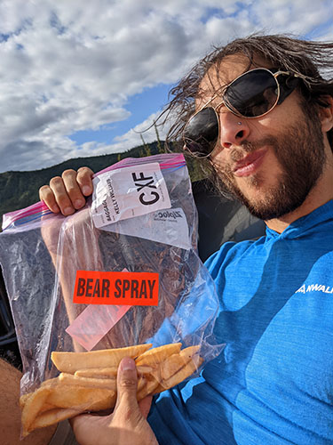
The real meat of the day began after arriving in Fairbanks. Once we landed, we took a Lyft to the local REI to pick up the bear spray and camp stove fuel Kelly had ordered ahead of time. The preorder was due to flight regulations barring possession or checking of compressed stuff. After getting our paws on the fuel and spray, we made our way to Sven’s Basecamp Hostel where we would spend the night before heading up to Coldfoot in the Arctic Circle the following day.
But wait, you didn’t think we were done with errands, did you?
We still had one more flight left to get to Coldfoot aboard a charter plane, which wouldn’t allow us to bring our stove fuel due to the afore-mentioned regulations. After settling in at Sven’s, Kelly and I took a 2 mile walk back to the airport to get our fuel on an overnight bus destined for Coldfoot, then on the way back we stopped at the grocery store for some much-needed booze.
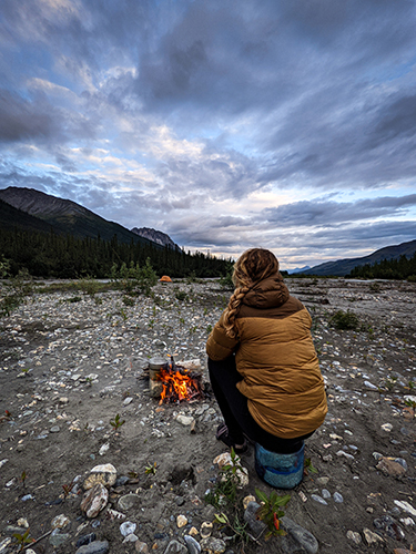
After finally making it back to Sven’s, filling up the flask with rum (this is how I learned one should always fill a flask with whiskey or something else strong), and downing the rest of the rum mixed with orange juice, we finally settled in on the root covered, $24 patch of dirt for the night.
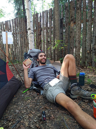
Me resting my tired bones and playing with the now full flask.
Day -1
Day number two of travel, and it would be a big one! After some in and out sleep, we were up at 6am to catch our charter plane to Coldfoot. The plane felt like something out of Indiana Jones. The back half was empty boards with runners and a palette of goods, with seats in the front half for me, Kelly, and two other lone passengers. The pilot was a very tall, spindly man Kelly and I dubbed Kurt, simply because that seemed a fitting name for him.
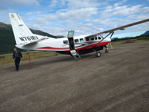
Kurt and the plane shortly after landing in Coldfoot.
The flight from Fairbanks to Coldfoot had so many beautiful views, I’ll let them speak for themselves!
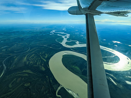
The Yukon River from the plane.
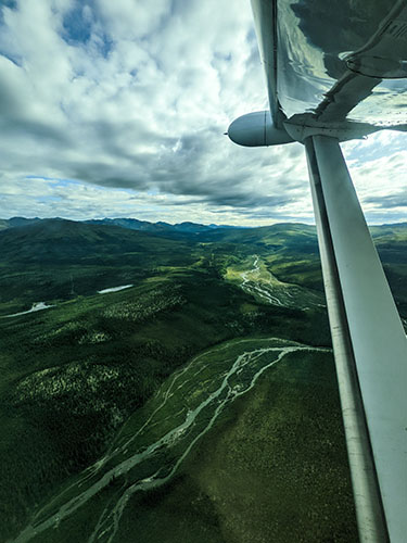
A stream in the mountains very close to Coldfoot.
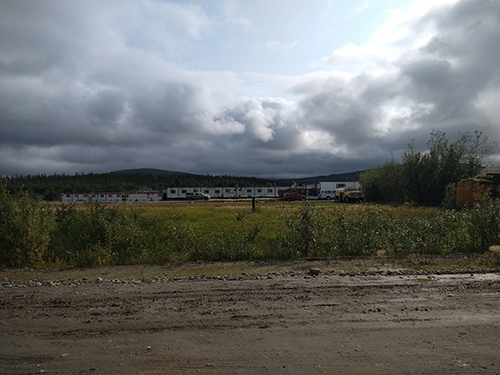
Our arrival would precede that of our camp stove fuel, so we hiked perhaps an eighth of a mile from the airstrip to Coldfoot, a truckstop with a restaurant, a hotel made from trailers, and the last chance for gas until Deadhorse some 240 miles north along the Dalton Highway, where our fuel would be delivered. There we had two enormous burgers and fries and sipped at some beers until the fuel set us free.
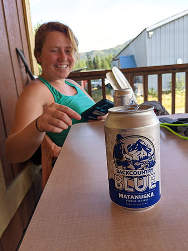
A fine, Alaskan brewed blueberry beer, and a fine companion to enjoy it with!
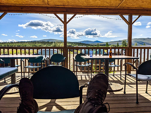
The view from Coldfoot while we waited. Not bad!
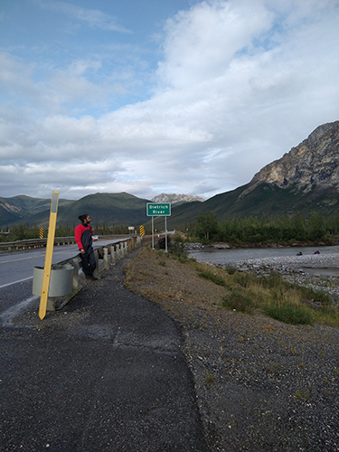
After making sure we had everything, we went back to the highway to attempt to hitch a ride 130 miles north to where we would finally begin our trek at the Ribdon River.
And there we waited.
For about two hours, we laid about in the sun, dancing around in the road, doing yoga poses, and humming tunelessly in between holding our thumbs out for semis and working trucks that blasted by us along with a fine coating of dust.
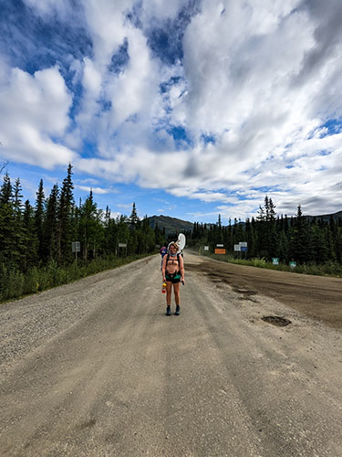
Where we were attempting to hitchhike on the Dalton Highway.
After we got tired of lying about, we just decided to start walking for something to do. We made it at most two miles before we were finally picked up by two caribou hunters, a father and son. After loading our gear into the bed of their pickup and hopping in ourselves, we were off!
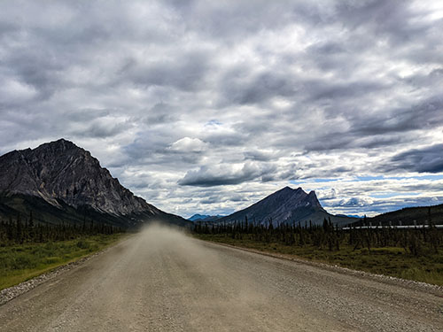
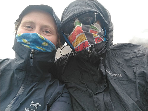
The ride was quite varied. After around 10 or 20 miles, the highway turned from asphalt to dirt/gravel, which made our ride a bit rougher and punctuated with rocks kicking up and hitting the underside of the bed. The views along the ride were spectacular, with stunning mountains and streams rolling past. Eventually the road took us to Atigun Pass, the highest mountain pass of any highway in the US. Up there it got misty, drizzly, and cold. I had started the ride in shorts and a t-shirt and Kelly had started in shorts and a tank, but by the time we hit Atigun Pass we were both bundled up soundly in long sleeves, long pants, buffs, and rain gear to stay warm and dry!
In the high mountains of the pass, we were lucky enough to see dall sheep poking around the cliffs, then several miles down from the pass the hunters pulled over to point out a grizzly bear meandering about the Sag River! This was the first grizzly Kelly or I had ever seen, and a good reminder of how wild an area we were going into. After leaving the mountains and hitting the tundra we had a more level ride and got to see a snowy owl swoop across the highway and across the landscape!
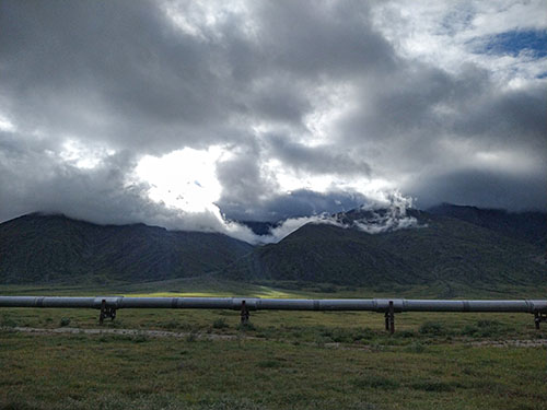
The oil pipeline from the Beaufort Sea follows the Dalton Highway the whole way.
Me enjoying leftover steak fries in the bed of the truck.
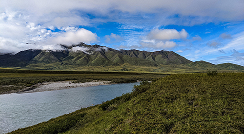
Mountains Dillon (left) and Sukakpak (right) behind us.
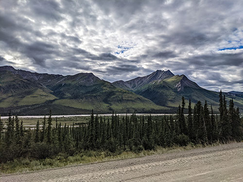
Mountains above the Middle Fork of the Koyukuk River.
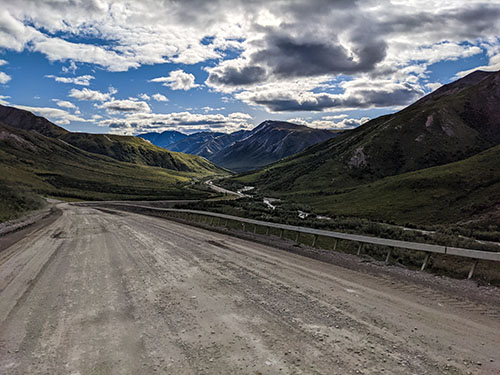
Leaving the Middle Fork of the Koyukuk River below as we ascended towards Atigun Pass.
Our getup through the pass.
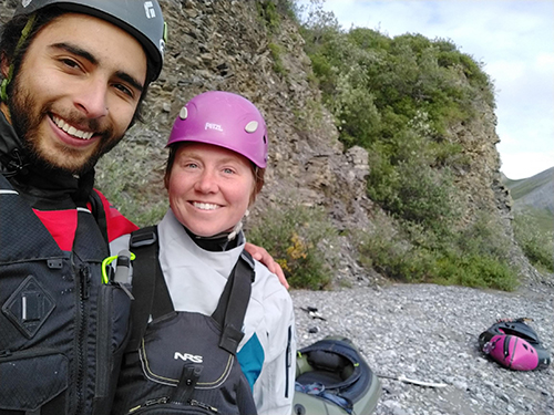
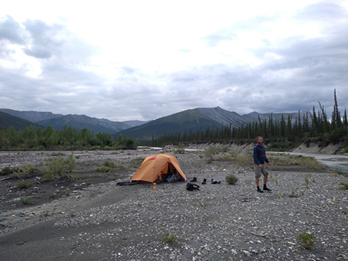
Once reaching our innocuous starting point, we banged on the side of the truck to signal our new friends to stop. We chatted briefly while getting geared up for the short walk to the river, and we were gifted with some bug spray for the trip. We hadn’t brought any, as we were banking on dressing to avoid bugs and hoping we wouldn’t need spray.
Boy, were we glad to have that spray later!
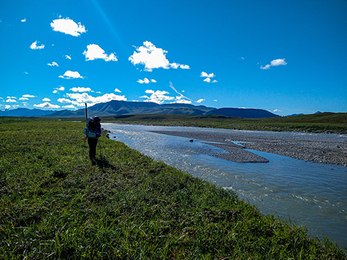
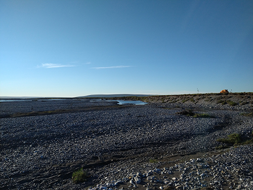
After saying our goodbyes and giving our thanks, we hoofed it across the tundra through soggy moss and low brush towards the Sag River.
We planned to ford all the way to the other side, make camp, then begin hiking up the Ribdon River on its north side.
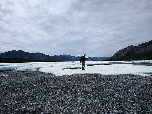
We made it halfway across the Sag to a rocky island before deciding it would be safer to ford using our rafts rather than walking. The water had reached slightly above our waists and was moving fast, making it very risky, even with two trekking poles each.
By this time, it was already 10pm, so we decided to just make camp where we were and finish fording the next morning.
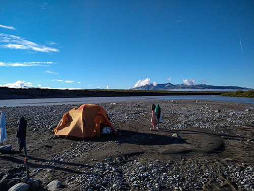
Camp 0
Day 1
The following morning, our first order of business (after breaking camp, of course) was floating the rest of the river. It was somewhat anti-climactic, as the actual rafting took us one third of the time setting up and breaking down our rafts took, but it was worth it for the safety!
Immediately after fording the Sag River
Our hike began with cutting over a hill to reach the Ribdon River, to then follow it upstream into the Brooks Range. The beginning of the day was rough for mosquitoes, but we applied our gifted bug spray at our first break an hour or two in and had instant relief.
The day was relatively uneventful compared to days past and days to come, but we did see some neat wildlife, including two herds of musk oxen, a gopher, and a lone, shockingly white seagull.
I’ll let the pictures of the day speak for themselves!
Just hit the Ribdon River!
Trekking along the Ribdon River
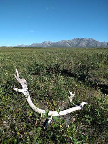
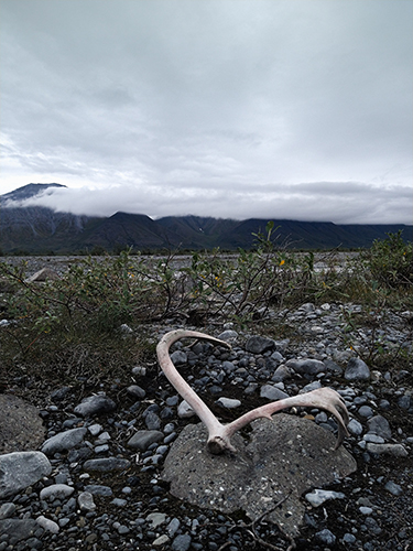
A caribou antler, roughly 4ft long
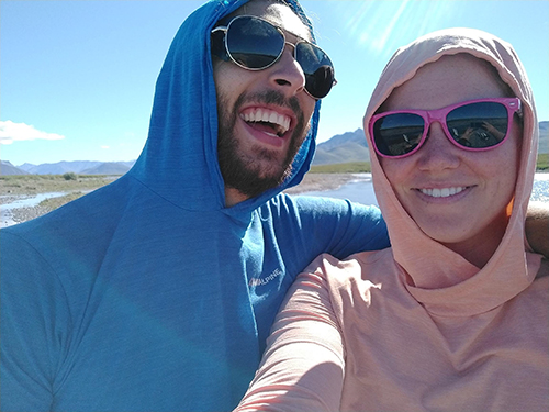
Stylin’ sunglasses
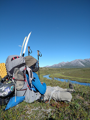
A break. It’s hard work.
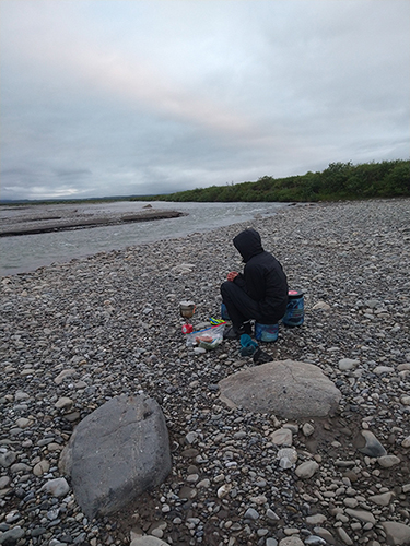
Once we made it to camp after 11 hours of trekking and just shy of 10 miles, Kelly went about setting up camp while I prepared a cook fire to make mac and cheese for dinner. On the river bar, we could see tracks from bears, moose, and a pack of wolves!
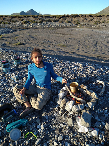
Cooking up some mac and cheese
Camp 1
Day 2
Day 2 started mistily moody as all get-out, making for a spooky early morning bathroom break. However, after getting started the mist quickly evaporated in the sun, leading to another beautiful day!
We spent the day following game trails through the thick brush. They can be hard to follow as they fade in and out, so we were constantly switching from smooth going on a game trail, to trying to keep track of where it was, to crashing through underbrush.
Our view the morning of Day 2 after hiking briefly
During our times on the river bar rather than the tundra we were seeing increasingly fresh moose prints in the mud, and eventually saw the culprit several hundred yards ahead in our path. He saw us as well and beat it to the river, much to our relief, never to be seen again (moose are known to be grumpy).
We also saw large amounts of bear scat, but luckily no bear to go along with it!
A break sheltered from the wind behind a hill
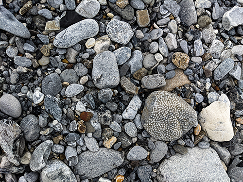
A Tabulate Coral fossil, one of many!
Yet another caribou antler
Towards the end of the day, we crossed a marsh near the river, and both Kelly and I had a similarly interesting experience! As we picked our way across the marsh, we occasionally noticed the iridescent rainbow of oil leaking into the water, and we both had the knee-jerk reaction of “ugh, pollution. Come on, humanity,” before realizing that it was natural!
What we were seeing was the exact reason we watch 120 miles of oil pipeline on the way up, the natural oil just seeping out of the ground. It was an interesting experience to notice our own biases and caused us to think deeply about the oil mining in such a beautiful, pristine place.
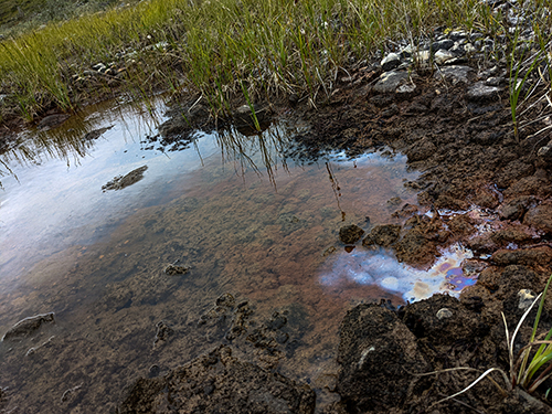
Nope, not pollution, that’s supposed to be there
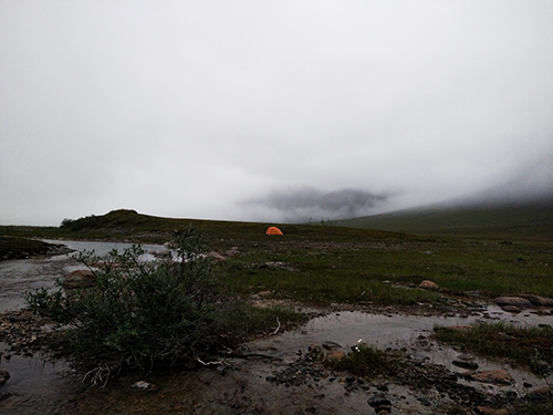
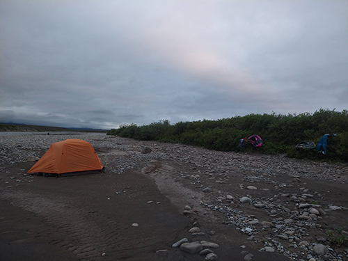
We made camp on the edge of a hill for high ground most of the way through the marsh, nice and sheltered from the wind. Dinner that night was dehydrated chili with instant potatoes and dehydrated kale, which ended up being my absolute favorite meal of the trip! Quite a shocker for me, a life-long hater of beans, but what can ya do.
Camp 2
Day 3
Day three dawned as most others, but this would easily prove to be our most interesting day of the trip. After the standard breakfast of oatmeal and breaking camp, we hit the trail.
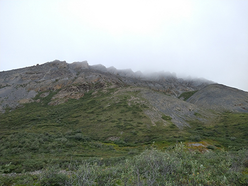
The morning mist made this craggy ridge look ominous high above
For roughly the first half of the day the trekking was standard weaving from river bar to tundra, following wispy game trails, and crashing through blueberry bushes. Every so often we would come across bear scat that looked increasingly fresh compared to that of days past, so we made sure to keep noisy just in case we run into the bear scat generator.
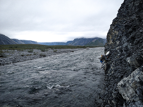
As we walked the river bar, the gap between tundra and the river bar began to grow steeper and steeper, and slowly approach the river itself. We trekked along the rocks steadily until the cliff separating the tundra from the river bar met the river itself. We looked behind us and saw that we would either have to back-track to hit the tundra, ford the river, or make the traverse.
Handily enough, there was a two-to-three-inch ledge right near the water level for footholds and the rock was bountiful in handholds, but extremely loose. We opted to do the traverse, and picked our way across it, Kelly in the lead.
I think her paddles were oriented on her pack differently, as mine would repeatedly scrape the rock above my head, sending small rocks crashing onto my shoulders and threatening to push me into the river.
For both of us it was a delicate balancing act between leaning into the rock enough to stay on and keeping our sixty-to-seventy-pound packs from pulling us into the freezing river.
Part way through the traverse, my knife, which had been clipped onto my shoulder strap, came out of the strap. I caught it just in time and completed the rest of the traverse with it dangling from the keeper strap clenched between my teeth.
Me almost through with the traverse
Soon after the above picture, the cliff became more like a tall, steep hill, allowing us to walk close to the river much easier, although it was still entirely loose rocks and no dirt. After perhaps 20 minutes, we came to another traverse, however this one was overhanging. One would be hard pressed to make that traverse even with rock shoes and with no pack.
Dreading the prospect of back tracking all the way back, we looked to the steep, rocky hill peppered with gullies for an escape.
I took one that seemed the least steep and seemed to offer less loose rocks.
Boy was I wrong.
It was like combining scrambling with swimming. The rocks were small to large and would give way to most steps, and what hand holds could be found had to be tested before being pulled on, as many were more like Jenga blocks than holds.
Halfway up I found a stance to stow away my trekking poles and to tell Kelly that she should find a different option.
Eventually my gully became a little less steep and found some dirt, and I finally was able to pull myself up over its lip and collapse in the grassy tundra, letting my heavy pack take me down.
I couldn’t rest though, I had to find Kelly. I immediately unbuckled from my pack and dashed across the top of the cliff-side searching for Kelly.
I found somewhat of a point and called for her, then stood stock still listening for a reply. After standing for maybe 30 seconds of hard listening and pondering how we could have been so stupid as to split up, I moved on and found her just around the corner moments after she herself had topped out.
Her gully presented with its own challenges, which can be found in her post linked above!
We estimate that the cliff we had scrambled up was roughly ninety feet tall, and we agreed that we probably shouldn’t do that again.
A picture from the top of my gully
After a brief break, we donned our packs again and moved off! We still had roughly 4 miles left in the day to continue hitting our goals, but the terrain ahead seemed to be flat river bar or flat tundra, which was heartening.
Walking along the river bar
The fossil of a shell
I was a bigger fan of walking on the river bar than Kelly, but we both had similar thoughts. The river bar had fewer things to trip over and less route-finding to do, but the rocks were juuust big enough that you had to pick your way from rock to rock and they could be rough on your feet.
The tundra, on the other hand, could either be firm, flat grass, thick blueberry bushes woven with faint game trails, and would sometimes have streams cutting hills into the ground.
We would switch from river bar to tundra now and then, whenever it struck our fancy. This was one of those times we decided to switch to the tundra, so we were making for a weakness at the point where they meet to hop up on the tundra.
As we emerged from a thick outcrop of alders growing in the river bar, we saw a grizzly bear mother with her ~1 year old cub EXACTLY where we were heading. She had seen us too and stood, leering at us, while her cub sleepily bobbled around behind her.
Kelly and I froze as the two parties took each other in.
I snapped a picture, then we turned around and got the hell out of dodge, skirting along the river bar around the two bears. When we could see their spot between the alders, we could see that she was keeping an eye on us as we passed, but as we were heading away from her, we could see she had flopped back down to continue her nap.
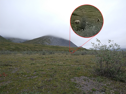
The two bears at about 200 yards
Seeing the bears gave us a spring in our step to put some miles between us and them, but we had already trekked eight miles when we had seen them, so we only put about two miles in after the encounter before making camp.
Once at camp we had a difficult conversation and some difficult facts to face.
We had been consuming our food a bit more quickly than we had anticipated and we had been barely making our mileage goals each day. Things were going at the bare minimum, so if we got tired or hungrier, we would start to not have a very fun time.
I am reminded of this quote from Galadriel in Lord of The Rings:
“The quest stands upon the edge of a knife. Stray but a little, and it will fail, to the ruin of all.” - Galadriel
Okay, so maybe not to the ruin of all, but you get it. The fate of Middle Earth didn’t rely upon us completing our quest, so we ended up making the call to turn back.
In the future, we would arrange for an airdrop of more food near the Canning River, which would lessen our load considerably. We had considered that option, but they are expensive, so we thought we would be able to hoof all our food.
Camps 3 and 4
Day 4
Day four was a somber day indeed. Even though we were feasting on our food after deciding to cut the trip short, we were both bummed that we would have to turn back.
We spent most of the day hanging around camp watching the clouds drift by and looking at rocks.
A plane did fly past in the afternoon
Day 5
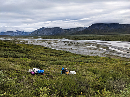
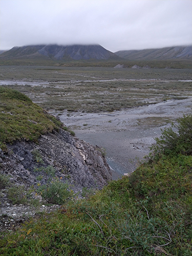
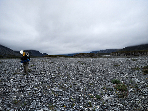
Today was the day we would raft all the way back down the Ribdon River to the Dalton Highway. The river bar around where we were camped was incredibly wide (on Caltopo it almost looks like a lake), so the river had braided into a dozen different small streams. We had to hike about 5 miles downstream until the braids came together just upstream of where our gully adventure happened on day 3!

Looking back towards our camp the night before. It was just at the foot of the smaller peak near center image
As we crossed the river bar, towards the end of the 5 miles, we came upon a field of permanent snow, and a curious lone caribou heading the opposite direction. He came within about 50 yards to check us out, then moved on up the Ribdon.
The permanent snowfield
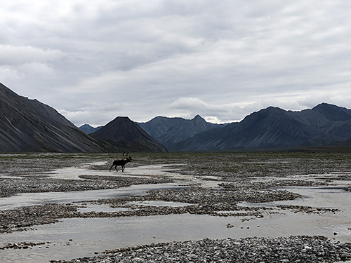
The curious caribou
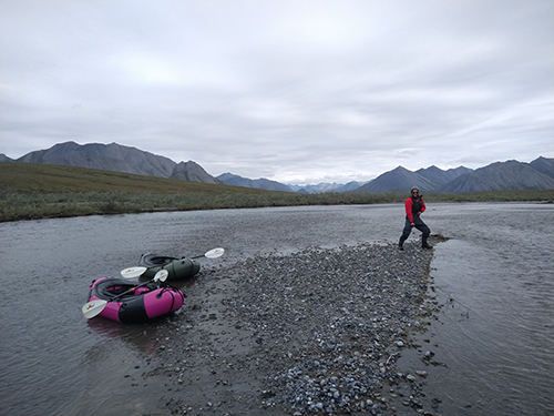
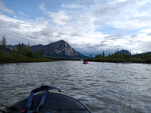
We finally made it to the point where the braids combined to form a raftable river, donned our drysuits, and set off down the Ribdon.
Ready to raft!
Initially, the rafting was mellow, and we even had to get out a couple times to walk our rafts. However, the further downstream we floated, the faster and deeper the river became.
The last mile held the most interesting sections of river. There, it gets to about class II and class III in sections, making our choice to forgo our spray skirts a worrisome one. However, Kelly and I were able to grit our teeth, bend at the hips, and cruise through all the rowdy sections.
By 10:30pm we were a quarter mile from the Dalton Highway, cooking some mac and cheese on a campfire.
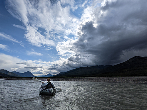
A short break while rafting
Whipping up some dinner late at night
It was an interesting and somber experience bailing from a trip and undoing three days worth of trekking in half a day of rafting. Every couple hours we would raft past one of our camp sites and watch it drift past.
That night, though, we definitely slept well, having trekked 5 miles and rafted 25 in a single day!
Camp 5
Day 6
After packing up camp and our rafts, which we’d left drying on bushes nearby, we hit the Dalton Highway. We hung around for hours swatting away bugs and trying to find ways to entertain ourselves between thumbing it at trucks blasting past.
A few hours in, a northbound vanhome with another car following stopped and said they would be heading back south in a few hours, after leaving the vanhome for its owners near Deadhorse, and would pick us up if we were still waiting.
A couple hours later, another father son caribou hunter duo stopped and picked us up!
Their names were John and Duke. John had a sailor’s tongue, which made us suspect he’d been deprived of adult company for some time, Duke was about 8 years old.
Their brake line had broken at some point, and John had patched it up with a camelback hose and zip ties, so he downshifted on every downhill to save the breaks for as long as possible.
We only made it with them about 10 miles south until they came upon some other hunters and a few caribou maybe a quarter mile away from the highway.
We chatted with the other hunters briefly before John and Duke geared up to hunt the caribou across the way. They crept off to hide under the pipeline to wait their chance at one of the caribou.
John and Duke stalking their caribou
We waited maybe an hour before the couple that were delivering the vanhome drove by and were gracious enough to pick us up.
Their names were Burni and Uta, and we learned they owned a bed and breakfast called The Arctic Getaway in Wiseman, a town maybe 10 miles north of Coldfoot with a year-round population of 11!
We chatted about our adventure and they recommended that we raft the Dietrich River to Coldfoot, which runs parallel with the Dalton Highway. They could simply drop us off on the side of the highway wherever we wanted and we could raft for a few days longer!
They even mentioned that there was a mammoth tusk sticking out of the riverbank that had become unearthed only a couple months prior.
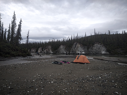
Naturally, we jumped at the opportunity. Burni and Uta dropped us off about 50 miles north of Coldfoot, and we spent the night on another rocky island.
Wolf tracks near camp
Cooking some more mac and cheese
Camp 6
Day 7
Our first day rafting the Dietrich River was constantly racing the rain. We started out having our standard of breakfast normally until we saw some storm clouds start to brew. We finished as quickly as we could and broke camp, but we were getting sprinkled upon just as we were getting to blowing up our rafts.
We made the small error of opting to stick with rain gear for the rafting since it would take a little bit to get our drysuits on and we were already wearing the rain gear. However, as the rain continued, we started to realize that the drysuits would make us quite a bit happier, so we had to was up and get those on.
Already feeling warmer!
The clouds shifting from rainy to sunny made for some stunning views with the shifting light and detailed clouds constantly moving across the sky.
The wind blowing the clouds around, sadly, was also present on the river. We would stick close to the shore when we could, but the river was winding and we would always find a place where we simply had to motor through the wind.
Gorgeous clouds abound
Dillon and Sukakpak, once again
Enjoying a quick snack and a break at a bridge where the Dalton Highway crosses the Dietrich River
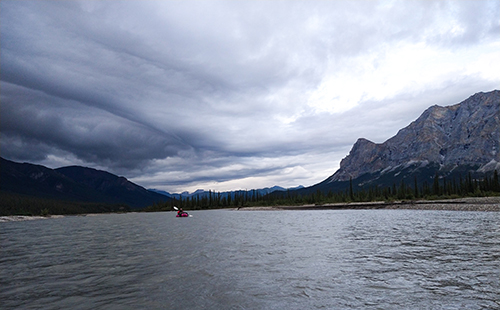
The clouds could be pretty intense
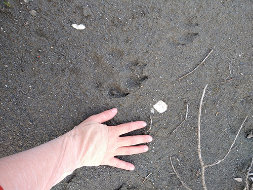
After a 30 mile day of paddling or so, we made it to our beautiful campsite at Vi Creek, just a mile from Gates of the Arctic National Park! The camping area was pretty muddy, which allowed it to boast some impressive grizzly bear tracks. After examining them, we figured they must be several days old, so we were comfortable camping there.
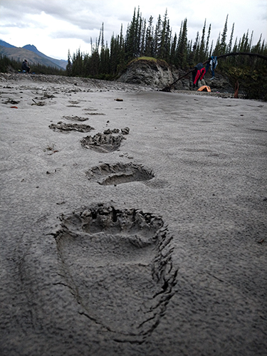
Grizzly tracks!
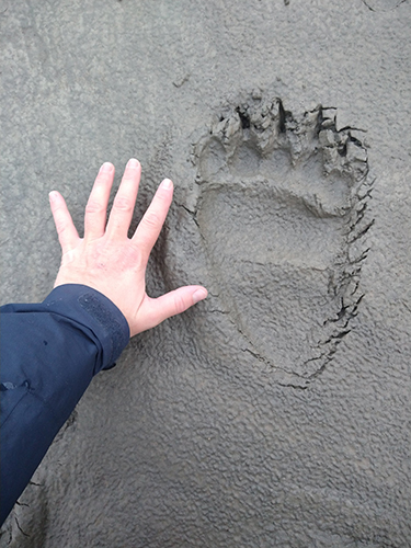
Size comparison with Kellys hand
Camp 7
Day 8
Destination: Coldfoot!
We seriously blasted through the 30 remaining miles. Berni and Uta had told us we should visit on our way past, but we were scraping it to make it to Coldfoot in good time, so we had to float right past Wiseman.
We kept our eyes out for the mammoth tusk, but Berni’s description of where it was was hard for us to follow, as he used a lot of names for places that we didn’t know of. The takeaway we got was it was on the left following a bridge, and there were only 4 bridges, so we figured that would be plenty!
However, after passing the fourth bridge and seeing nothing, we figured we had probably missed it.
Another couple of miles later, Kelly was far ahead of me and I was watching the steep bank go by and wondering if we would be able to walk it were we on foot, I noticed something that caught my eye.
There was a rope extending from beyond the steep, clifflike bank down to an object around the middle of the bank. As I rafted closer to check it out, I realized it was the mammoth tusk! I got as close as I could and let the river whisk me past, staring in awe and imagining how it once roamed Alaska thousands of years ago.
In my awe I forgot to take a picture.
After pushing hard against the wind to make it to Coldfoot in time for a burger, we finally came upon the Coldfoot airport, which stood just between the river and the truck stop.
We got out of the river and carried our rafts to level ground, where we were greeted with a beautiful rainbow!
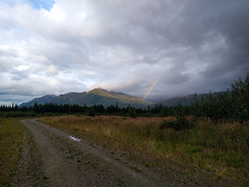
Our welcome rainbow
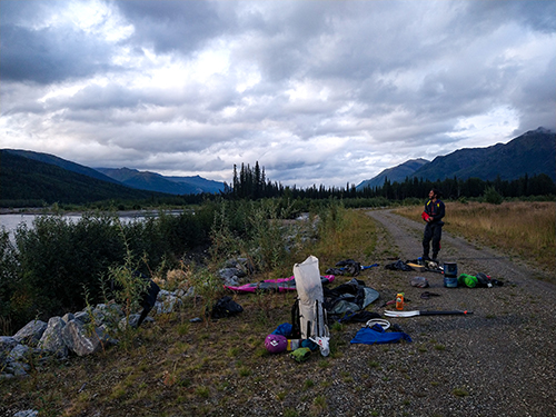
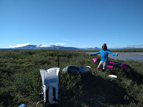
A gear explosion
We were able to make it to Coldfoot in time to order a couple amazing, greasy burgers, and folded for an insane $200 hotel room in a network of trailers, relics of the older oil drilling operations on the ice in the Beaufort Sea.
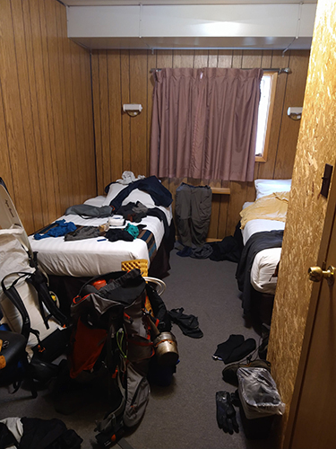
Our Coldfoot hotel room
Camp 8
Overnight, we vowed one thing to the North Slope and the Canning River:
We’ll be back.
Objective
To Hike from Toolik Field Station on the Dalton Highway through the Brooks mountain range to the Canning River, raft to the Beaufort Sea, then hike to Deadhorse in Prudhoe Bay.
To raft the Ribdon river, then take the Middle Fork of the Koyukuk / Dietrich river back to Coldfoot camp.
Statistics
218 Days~18735 Miles of Hiking~7280 Miles of Rafting130220 Miles of Hitchhiking- Caltopo Map
- Kelly's Blog Post