Climbing Acatenango
November 6th-7th
Not designed for mobile viewing. It's prettiest on a computer!
I write this post from a very cute hostel in Antigua, Guatemala with green trees and lush plants all over the place, sitting at one of the few chairs with an outlet nearby that has a too thin cushion. Yes I wrote the first two Guatemala posts one after the other.
November 6th
Before heading out to the volcano by bus, we had to get some busy work done like cooking our quesadillas for the trip and packing for it. Ya know, small details like that. By about 10am we were ready to roll! We walked to the other side of town where the bus terminal was, but happened upon our bus before we hit the terminal by someone shouting "parramos!" at us while standing next to a parked bus. He turned out to be the guy who throws bags on top of the bus when necessary and collects payment from passengers! Anyway, we hopped on and quickly learned that everyone was hanging out in the front of the bus because there was crazy loud music blasting from the speakers in the back of the bus. The bus driver also drove like an absolute mad man, flying through tight corners while honking his horn as a "watch out, insane bus coming your way!" Also, apparently these busses are called "chicken busses." Not sure why, but they're basically school busses with crazy decoration on them that makes each one unique!
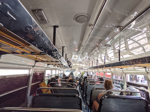
Inside the chicken bus
We took that bus to Parramos, hopped off, then waited for the next bus that would take us to the trailhead. We had to ask some local cops where to get on the bus since there aren't really "stops" here apparently, and we hung around patiently. A taxi driver came by and chatted us up, then offered to take us there in a tuktuk for about 10-20 times the amount the bus would cost, so we obviously declined!
The bus eventually arrived and we had another somewhat harrowing ride to the trailhead, which was all go right from the beginning, making a bee-line directly up the mountainside. We headed directly up this gravelly trail etched 3-8 feet deep into the cornfields for about .4 miles until arriving at an unexpectedly crowded restaurant with a bunch of tourists.
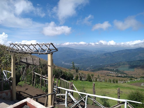
The view from the restaurant
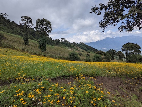
Field of wildflowers on the ascent
From the restaurant it was more of the same! Lots of beautiful wildflowers lined the trail until the fields gave way to jungley forest. The guided groups of tourists were pretty bad until we reached the pay station to pay the entrance fee for the reserve. There wasa large crowd there as there was a little bit of paperwork to do, and it seemed that some of them also used the area as a break spot. Kelly and I didn't really want to hang around, so we shot off up trail as soon as we got squared away, and were almost instantly alone on the trail. We suspect we also took an ascent trail used less by guides. The trail we chose was steep and had a lot of switchbacks (zig zagging up a steep hill in order to reduce the grade of the trail. It means your hike is less steep, but a longer distance compared to if you went straight up), then followed a contour until it met back up with the normal trail slightly less than a mile before camp. In comparison, the more frequently used trail seems to spread out the elevation change among the whole thing a lot more evenly. We used that one on the way down for a change of scenery! (You can get a lot more context for this trail description by going to the Caltopo link in the stats section of the sidebar)
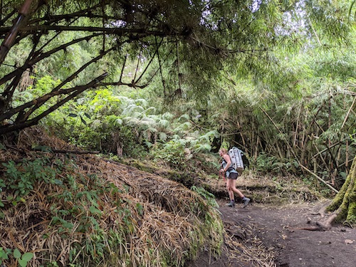
Kelly on the trail soon after it turned to jungle
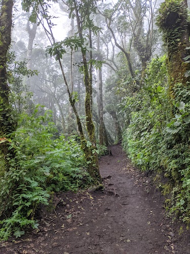
We hiked in a cloud sometimes, which made for a lush, damp atmosphere!
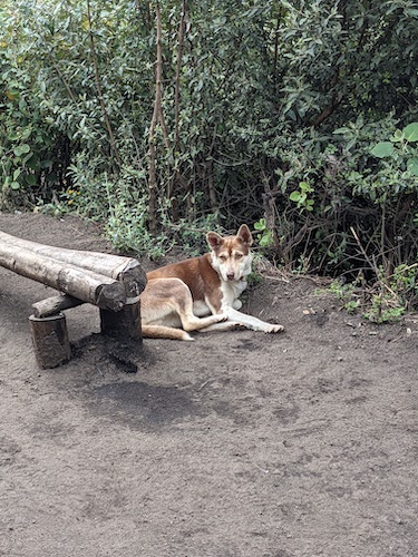
A very cute stray dog at one of our break spots
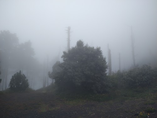
Dead trees in a clearing where the trail leveled off. The reserve was stricken with a wildfire some years back that weakened the forest, which is now under siege by beetles that can kill a healthy tree in 90 days.
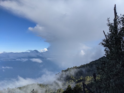
Beautiful clouds close to where we joined the main trail again
As soon as we neared the main trail we could hear the chatter of people, and before we knew it we were back with the crowds! The trail from there to the basecamp area was pretty level, so we kicked it along there at a good pace, excited to make camp and rest our tired bones! We rounded a corner and got our first view of Volcán Fuego... JUST as it erupted, sending molten rocks and smoke flying! I let out an audible "whoa!" and stumbled back a bit as it was so unexpected, which caused Kelly to almost die of laughter and a man trekking about 30 feet ahead of us to turn back then laugh and continue hiking. Anyway, we kept hiking and got a lot of cool views of what was in store for our evening and night!
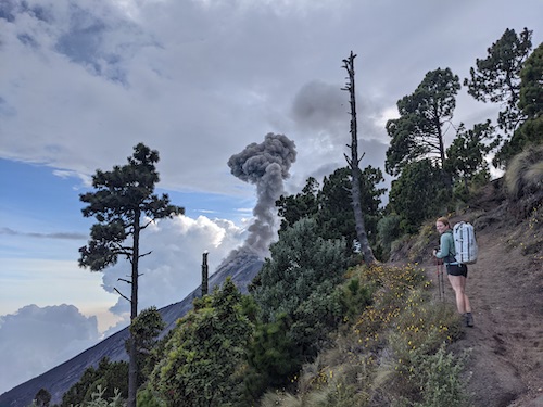
Kelly with one of the first eruptions for which we had a closeup view
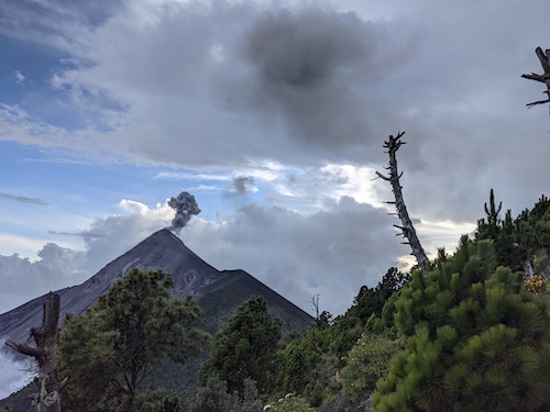
Another eruption from the trail
When we finally made it to the basecamp area we were glad to see that it was still wooded, so we could get some privacy from other campers. However, there wasn't much level ground, as the mountain was still hella steep there. All the guiding company basecamps were strips dug out of the mountainside, and were pretty obviously inhabited. We continued to hike up through the now patchwork of trails leading to one basecamp or another, until we reached one that seemed empty save for two guides. We asked if we could stay there but they seemed to want us to pay to stay in one of their old, leaky tents(we assumed they were leaky because they were all covered by tarps), so we moved on. A few minutes later, as we passed below another basecamp, two guides called down and asked if we were heading to the summit to camp. We responded that we hoped not, we were just looking for a place to set up camp. They beckoned us over and offered us a flat, empty area a short distance from the row of tents their clients were staying in (who were all in chairs under an awning on the other side of camp). We gratefully accepted and began setting up our tent and whatnot. The two guides were super nice and chatted briefly about where we were from and about how our tent was pretty nice.
Later on a family of 4 arrived and set up camp next to us, but we all kept to ourselves! After getting our camp set up, Kelly and I made a little sitting area out of my sleeping pad and had dinner while observing the volcano erupt. It was so amazing to watch from our vantage point. For the bigger eruptions, we could see magma shoot into the sky, then back down onto the sides of the volcano and slide down its banks. After it got a little darker we could see the red glow from the eruptions and see much better how they coated the side of the volcano on the big eruptions! I was really feeling the fatigue from the long day, so I ended up crashing around 6:30pm, not long after dark. I did, however, have time to get some neat night photography of some of the eruptions!
Also we got some cool videos of the eruptions!
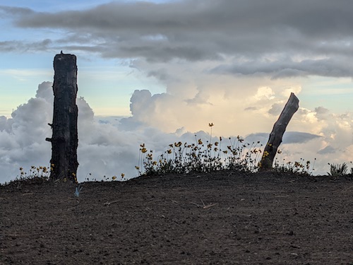
Looking out from our tent
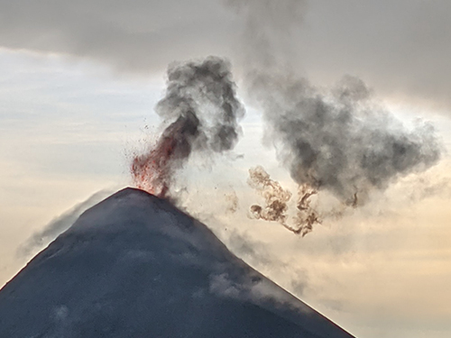
A closeup of one of the bigger eruptions
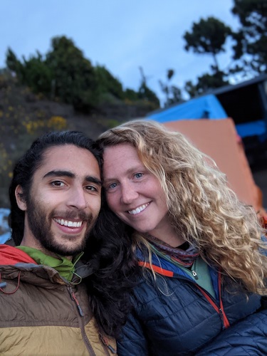
I played with the cool camera features on the Pixel 4a while waiting between eruptions; Here's portrait mode! Neat!
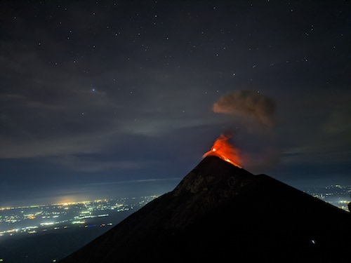
I played with the astrophotography mode after nightfall with the eruptions
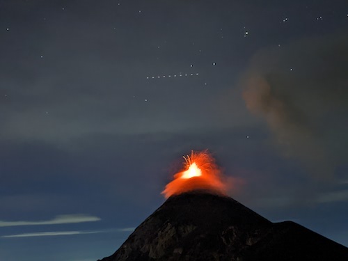
A neat long exposure with a big eruption!
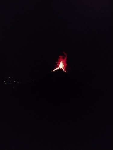
A photo Kelly got after I crashed for the night
November 7th
I slept like a rock pretty much all night, somewhat to Kelly's chagrin. She was repeatedly awakened by the booming eruptions from the volcano next door. I only awoke twice: Once when an eruption somehow sparked an intense dog fight mere feet from our tent! We feared we might somehow get dragged into the fray, and it sounded pretty brutal. Luckily they calmed down after a couple long, long minutes of brawling. Then I awoke again when the tourists with the guide company awoke before dawn to be taken to the summit to watch the sunrise. For some reason they had a lot to do and say directy in front of our tent... ah well.
Kelly and I had a nice slow morning observing the sunrise from our cozy tent, then having some breakfast while watching more eruptions next door. We started packing up and getting ready to head for the summit just as the tourists returned from the summit themselves.
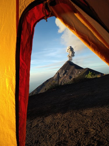
An eruption from our cozy tent
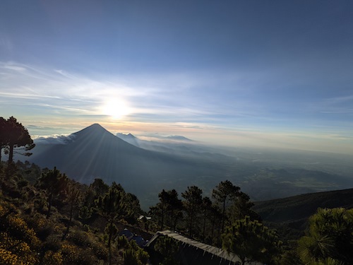
A beautiful sunrise in the alpine
Once we were all packed up, we headed uphill on the most trafficked trail we could find! Which turned out to have been a wrong turn immediately. Luckily for us, it was just a different trail to the summit, merely not the one we had intended on. So we continued! We eventually reached a section of trail that was like swimming up loose gravel. Every step would sink back a half step, making progress frustratingly slow and hard earned. We cut across to a nearby trail that switchbacked up the mountain that was a bit more firm, thankfully!
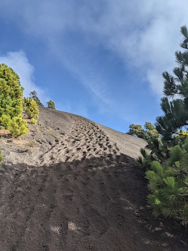
The offending trail
Up up up we went! Eventually we reached another section of trail JUST like the old, soft one that was unavoidable. We slogged up it for about half an hour to 45 minutes straight to the caldera at the top of the Acatenango! We'd made it! We were very ready for a break, so instead of making for the summit just to our right, we went to the other side of the caldera where we could take a break and have a great view of Volcán Fuego from 1,500ft higher than we'd had at camp. It made for some nice pictures!
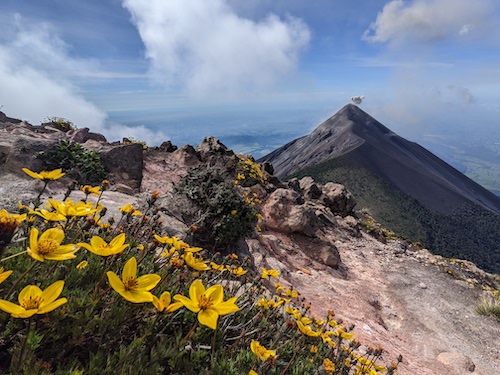
A smaller eruption
Eventually clouds started rolling in and obscuring our view of the volcano, so we took that as a prompt to get moving. Kelly hiked around the other side of the caldera while I hiked directly into its center, just for kicks because that sounds neat, then back out on the other side to the summit. We took another quick break here as well, because come on, you can't summit something and not hang out on the summit for a bit.
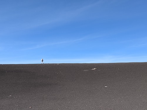
Kelly hiking along the caldera
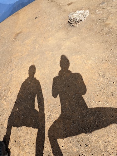
A weird summit selfie
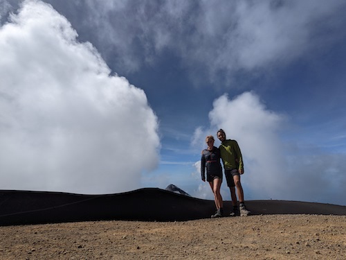
A normal summit selfie
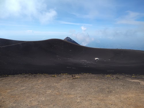
Volcán Fuego seen with the caldera for Acatenango in the foreground. That white lump is a delapidated hut.
At this point we were pretty tired and ready to be down. It was pretty much entirely down hill from here to where we would catch the bus. That sounds really good, but after about 10 minutes of hiking you really start to feel it in the knees and calves! Also, I relearned the same lesson I did on Ixta... hiking volcanoes seriously calls for shoes with treads. Anyway, we went down the way most guided groups take for a change of scenery, with much slippingn and sliding on my part, and we finally made it back to the road just under 26 hours after we'd started! There were some women selling wares just across the street, so we popped over to ask if this was where we could catch the bus to Parramos. They said yes and seemed to indicate that we should scram to the other side of the road stat because the bus would soon come flying around the corner, and sure enough it did! We had about 1 minute of resting at the trailhead before being thrust into the thick of it again with chicken bus insanity.
It was an uncomfortable 20 minute ride to Parramos because we hadn't had time to organize our packs, so I still had my trekking poles extended and had to finesse them closed in a crowded bus while not stabbing anyone! (although apparently I lightly stabbed Kelly once or twice, sorry Kelly!) After reaching Parramos, thankfully, we had maybe 10 minutes to breathe before catching the next bus, which was even more full! We had to put our packs on the roof of the bus in order to fit, which was a little scary since they had half our lives in them. We made sure the attendant (an absolute mad lad) tied them down properly. He was insane. Part way through the ride he sifted through the middle isle to collect fares, but it was too crowded to get back that way. Instead, he opened the back door of the bus flying down Guatemalan country roads at 40 miles an hour, hung on to the ladders on the back, then hopped out when it slowed down at a corner and got back in through the passenger door at the front. Holy shit.
Anyway, we arrived at the bus terminal in Antigua, which turns out is basically a big parking lot for busses, then tried to make our way back to the hostel. I knew the rough direction we had to go, and I figured we could cut through a market to see something new! Boy was I wrong, that was the opposite of a short cut. We kinda felt trapped in a labyrinth of stalls, and they weren't even open to the air, there was a roof over the whole thing! It was dark and musty, different smells drifted through aimlessly, both blissfully nice smells and rank smells. Some of the areas were lively, with all kinds of different stalls... then some areas were completely devoid of people, giving us only trash and shadows for company. Kinda spooky sometimes.
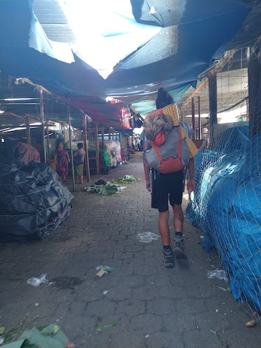
Just after we entered the market before we went into the dark underworld feeling part
Eventually we made it out from the north side rather than the east side, but hey, we made it! As we were walking through the parking lot to the road, we heard a commotion behind us that turned out to be a pack of dogs running another dog out of town. After the dog fight the night before we were a little on edge, but they left us out of it again!
We spent the rest of the day sitting around like bumps on a log, shit's tiring!
November 8th
A rest day. We somehow ended up walking (and a little limping) around town, getting lunch and checking out the shops. The shops are insane here! What you think is a little shop sandwiched between restaurants is actually a hallway leading to a thriving market that sprawls out BEHIND the restaurants. I love finding hidden city stuff.
November 9th
Which brings us to when I'm finishing this post! It's the morning of the 9th, and Kelly and I are getting ready to drive into El Salvador this afternoon. Our legs are still hella sore from Acatenango, but ain't that just the way.
More updates to come!
Statistics
- 25 Hours, 18 Minutes Trailhead to Trailhead
- 8.46 Miles
- 5,089ft Elevation Gain
- Caltopo Map
The Plan
To climb Acatenango, a 13,045ft volcano in Guatemala. We will spend one night at ~11,500ft observing Volcán Fuego, an active volcano roughly 2 miles away that erupts every ~5-10 minutes.
TL;DR
The plan goes perfectly. It's very commercial, lots of guided trips.
If there's something I wrote too little about, make a comment or reach out to ask to hear more, I'd love to answer any questions!