Mount Henry Traverse
Not designed for mobile viewing. It's prettiest on a computer!
The Trip
While spending a week with my friend in Colorado, I desperately wanted to have my first alpine experience. After scouring the internet for fun 14'ers and 13'ers to do (most are concentrated around Denver in Rocky Mountain National Park), I found a fun trip report of someone who did a 15 mile loop, summiting Mount Henry, a 13'er, on the way! It looked like it would take about a day and be a really fun introduction to the alpine, as it is at most a scramble, meaning no ropes or gear necessary!
I had my hopes up that I would encounter serious enough snow to need snow gear, so I picked up some microspikes from a local gear shop in Gunnison (If I buy the gear, that means I'll have to use it, right?).
The morning of the trip, I packed up a nalgene of water, threw some snacks (airheads, fruit snacks for the trek and cheez-its for a summit celebration), a couple layers, then blasted off into the wilderness in my friends Subaru.
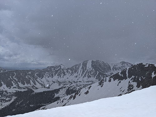
After parking at the trailhead at about 8:45am, my chosen route threw me right into the thick of it with a steady hill climb to 12,000ft in roughly 2 miles, gaining the ridge after just over half a mile. The forest in this section was mainly populated by beautiful conifers, which made the hike eerily silent save for the crunch of my footsteps.
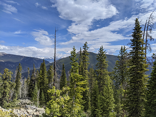
The view just after the trees began to thin almost 2 miles in.
Eventually snow started to accumulate and I had to navigate between mazelike drifts that grew harder and harder to avoid. Eventually there was no ground visible and I had to wade through snow of varying depths, sometimes able to stand atop the snow, usually not. The higher I rose the more I was able to walk on the snow, and after I finally passed the last of the trees I came to a long snow patch leading to the first summit of the ridge I woudl be traversing to Mount Henry! Here, I finally donned my new microspikes for the first time, and I had an absolute blast with them. They came in handy, as the hill was fairly steep and my weathered boots would have slipped dreadfully without the spikes!
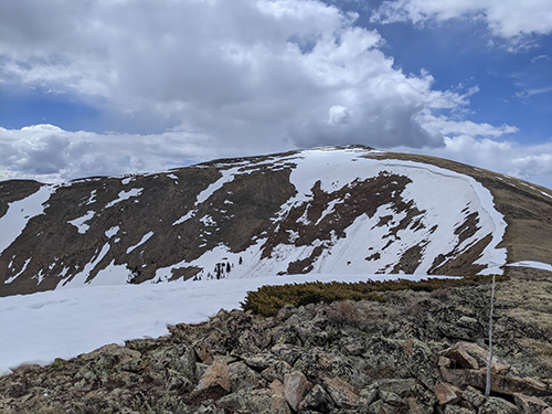
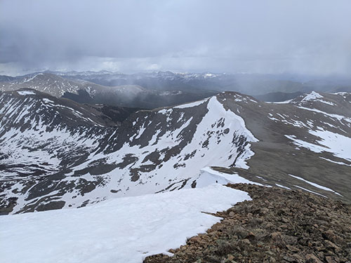
The view from the first summit of the ridge traverse. Pictured is the path ahead, following the line of snow.
After a brief snack break atop the first summit, I simply followed the ridge for what seemed like hours. Just one step after another, leading to summit after summit, always with another behind it to overcome.
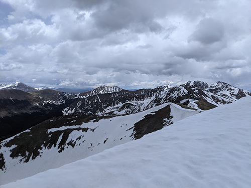
My first view of the terrain to come. It continued to get more and more barren!
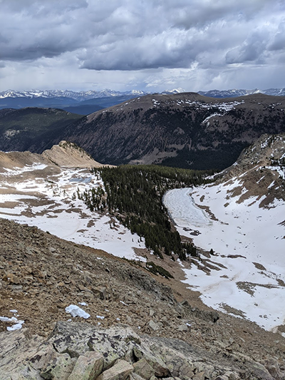
I passed several frozen alpine lakes in the valleys below the ridge.
During the traverse, pikas (small rodents that live at high altitudes among the rocks) would emit loud squeaks, presumably to alert their fellows to my presence. They were extremely hard to see against the terrain, and they would stay very still except to dive between the rocks. Furthermore, the weather was constantly threatening (and occasionally following through) precipitation. Now and then thick, dark clouds would cover the sun and snow would drift down, until swift gusts of wind would blow them away. I was constantly switching between wearing my light jacket with the hood up and tight and just wearing my t-shirt due to the wind. At one point, I experienced active snowing while basking under the sun for the first time!
During one of the worse bursts of snow, I caught my first glimpse of Mount Henry across the valley.
My first view of Mount Henry (center peak).
After reaching the ridge surrounding the valley beneath Mount Henry, I made my first alpine error: attempting a shortcut. I saw on the map that I would have to climb the ridge to the next summit, then descend the ridge back to nearly exactly the elecation I was currently at. I thought to myself, "why deal with all that elevation gain/loss when I could just traverse at the same elevation?" Why indeed.
Bravely and blindly I plunged on. I traversed across several snowfields interspersed with patches of rock, stamping my feet into the snow sideways for each step to create level ground to stand on.
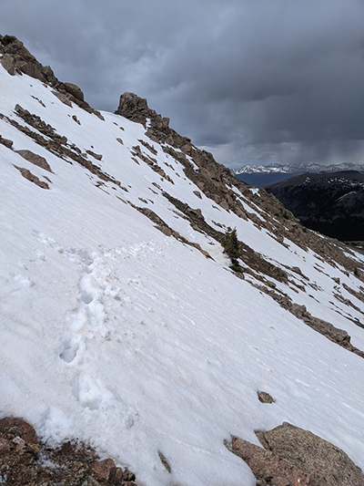
Looking back upon one of my snow traverses. The image is perfectly level horizontally.
Midway through traversing under the peak I was trying to avoid, two birds whizzed from the top of the ridge down the mountain, one flying mere inches from my head! I only became aware of them during their flyby, and after jumping like a frightened squirrel I looked down the mountain and saw the two black specks recede into the trees. I stood for a few moments to ensure that I wasn't number one on their hit-list, but thankfully they didn't return!
At this point the snow gave way to more rocky terrain that was somewhat difficult to navigate, including two rocky sections split by a stationary river of snow. The river was steeper than what I had previously navigated, steep enough that I feared sliding all the way down should I attempt to walk it. It was only about 5 feet wide though, so I overcame that obstacle by leaping from one side to the other and grabbing at features of the rock on the opposite side to avoid placing too much weight on my feet.
After the snow river, I wound my way through the steep rock around a corner, constantly looking for how I could regain the ridge to continue on the trail. That opportunity was not forthcoming. I kept climbing the rock higher and higher, as further on at my elevation it was extremely steep and loose. Eventually I realized that the snow that bordered the ridge formed a vertical wall on my side of the ridge, making it near impossible to safely regain the ridge where I had intended. I climbed the rock higher, following a fold until I reached the wall of snow. The fold I had climbed up formed a weakness in the snow, where it was roughly 20 feet tall and merely steep until it became vertical for 2 or 3 feet at the very top. It was this or go back to where I had initially diverged my path.
I donned my microspikes once more and front pointed my way up the hill, using my hands as claws and wishing I had an ice axe. Then, before I knew it, I was over the lip and standing back on the ridge with sweet, sweet level ground under my feet! Below me was a great view of the valley beneath Mount Henry.
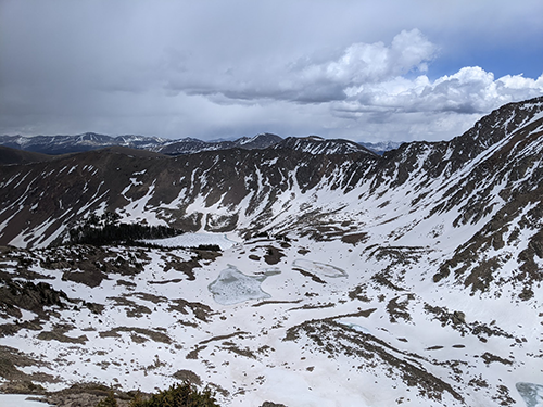
A great view of Henry Lake after getting back on the trail.
After my exciting detour, the trail up to the summit of Mount Henry was relatively uneventful. The altitude was such that every time I took a brief break from hiking, I could feel my pulse beating in my neck as I took deep breaths.
The summit was cold and windy, making my cheez-it break not quite how I had been imagining it for the last 3 hours, but none-the-less ambrosial. However, the work had only just begun, and I was running late (summit at 3pm); I still had to get back!
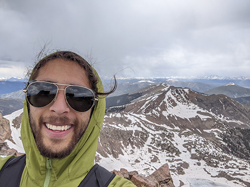
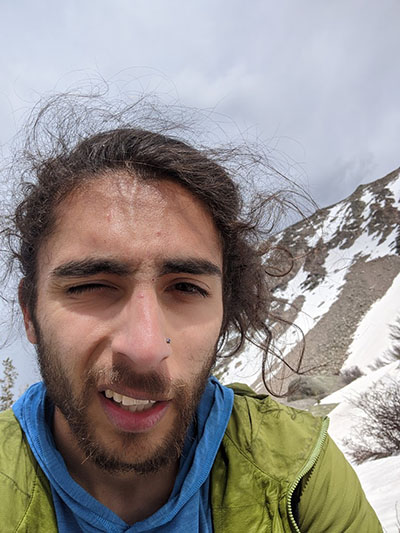
Summit selfie!
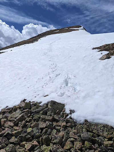
The way down - It follows the ridge before turning left, down into the snowfield with trees in the left of the image.
On the way down I had to descend several thin snowfields, and I got my first experience glissading! It was super fun being able to cover ground so quickly by scating on my left foot using my right to propel me and keep balance!
Pictured is my first ever glissade!
I was starting to feel pretty worked by this point, but, unbeknownst to me, the worst was yet to come! I descended from the peak of Mount Henry along the ridge into the saddle between Mount Henry and Squaretop Mountain, which stood 50 feet shy of 13,000 feet. Due to being so tired I opted to skip summiting Squaretop and simply skirt the summit to pass it on my way to Fossil Ridge.
Eventually I reached Fossil Ridge, a scrambly, rocky ridge peppered with pre-historic fossils! It is bisected by "Gunsight Pass", through which a trail passes through that I would use to return to the car. I scrambled down the ridge marveling at the ancient fossils, remnants of when this land was deep under the ocean.
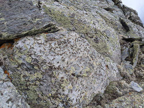
The fossils that peppered the rock on Fossil Ridge
I had a couple fake-outs on what was Gunsight Pass. There were two points where there seemed to be a channel through the rocks about 10 to 20 feet high that could absolutely have been coined the name "Gunsight Pass," one even seemed to have a trail! The first I discounted due to not being close to the GPS marker I made on Caltopo. The second got me, as it was almost right on top of it. I began descending from the ridge, but quickly came to realize I was heading down a couloir that definitely called for crampons and an axe, if not a rope as well. Going back up was not very appetising, so I decided to ascend a portion of rock graded around 5.2 to regain the ridge. About 50 feet of scrambling later I came upon what was undeniably Gunsight Pass.
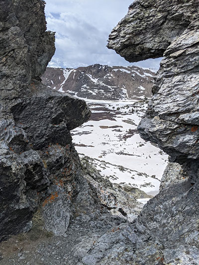
The view from Gunsight Pass, looking towards my destination
From Gunsight Pass I traversed the steep bank bearing down, and eventually was able to glissade down the rest of the hill. Towards the end of the steepest part, I began to have my first post-holing experience! For a couple minutes it was a little fun, I would be walking across the snow, then suddenly a foot would punch through the crust and would sink as shallowly as to my knee, or as deep as my waist. I would scoot my back foot to the front and use my hands to get back on top of the snow.
This quickly grew old, as it would happen more and more frequently the further I went. Additionally, the snow covered the trail I was following, but I was able to keep up with the creek under the snow that the trail followed by the sound of the babbling water. Eventually, I found every opportunity to stay off the snow, from making a beeline for a rock and leaping from it onto the snow to walking over bushes 75% buried in snow. At times, when I would be waist deep in snow, I would simply crawl out, then skitter across the snow like a panicked lizard in the hopes that distributing my weight would keep me from sinking in again (but mostly out of frustration, to be honest). Once I made it into the trees it got worse, as the snow was even weaker near each tree. I found deep footprints heading in the same direction I was by someone who seemed to be in a similar predicament. Where I could find the prints, I would step in them as the snow was harder packed there, which eased my passage a bit. Sometimes I would lose them and make my own way, but they would always reappear at some point! Great minds think alike, I guess. I didn't take many pictures during this part because I was not having a lot of fun.
My mood at this point.
After postholing for what seemed like forever (actually about an hour and a half) and covering two miles, I FINALLY made it to solid ground. After this it was a long slog of about 7 miles back to the car, but I was thankfully able to enjoy the beautiful scenery and trees I had been looking down upon on my way along the ridge!
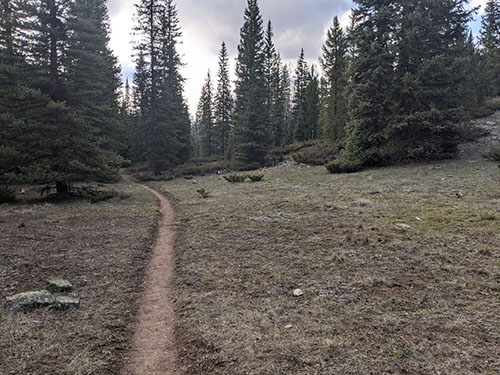
Finally, dirt!
I knew I was late as hell, and I'd agreed to meet my friends for dinner in Crested Butte that night. I activated my SPOT to send them a message that I was running late, but, unwilling to wait in place for it to send a message, I continued hiking and the message never got out. When I finally made it to the car at about 9:00pm and made it to the restaurant with an hour to spare before closing time, just in time to not be that jerk who orders while they're trying to clean up the kitchen, and my friends had already taken the bus there and had a few drinks downed!
All's well that ends well :)
Objective
To successfully summit my first 13,000ft peak and complete my first alpine objective!
Statistics
- ~15.6 miles round trip
- 5,804ft in elevation gain
- ~12 hours car to car
- 6 miles traveled above 12,000ft
Caltopo Map